Official Discussion issued by the National Hurricane Center
Sean (AL192023) DATA RELEASED: 10/11/2023 9:00:00 PM UTC
|
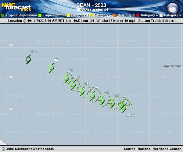
Copy of official data Tropical Storm Sean Discussion Number 4 NWS National Hurricane Center Miami FL AL192023 500 PM AST Wed Oct 11 2023 Sean remains poorly organized this afternoon. Satellite images show a ragged convective pattern with the low-level center located on the west side of a fragmented curved band, a bit more north than previously estimated. The Dvorak estimates remain steady at T2.5/35 kt, so the initial intensity is held at 35 kt. However, as mentioned this morning, this wind speed estimate could be a little generous based on the earlier ASCAT pass. The storm is currently experiencing moderate to strong southwesterly wind shear, and may only have a brief opportunity to strengthen over the next couple of days before it moves into an environment of drier air by the end of the week. Over the weekend, another round of shear should cause Sean to ultimately weaken and then degenerate into a remnant low in 4 to 5 days. The NHC intensity forecast has not changed much from the previous advisory and is within the guidance envelope. Sean is moving west-northwestward at about 11 kt, and is expected to continue moving in this general direction over the next day or two. After 48 hours, the storm will begin to turn to the northwest as it moves along the southwestern portion of a mid-level ridge to its northeast. Over the weekend, a turn back to the west-northwest or west is anticipated as a low- to mid-level ridge re-establishes itself to the north of Sean and it becomes a more shallow cyclone. The NHC track forecast has been shifted northward of the previous one over the entire forecast period based on the initial position and subsequent model guidance. FORECAST POSITIONS AND MAX WINDS INIT 11/2100Z 11.6N 35.3W 35 KT 40 MPH 12H 12/0600Z 12.1N 36.5W 35 KT 40 MPH 24H 12/1800Z 12.7N 38.1W 40 KT 45 MPH 36H 13/0600Z 13.4N 39.7W 40 KT 45 MPH 48H 13/1800Z 14.3N 41.1W 40 KT 45 MPH 60H 14/0600Z 15.3N 42.3W 35 KT 40 MPH 72H 14/1800Z 16.4N 43.6W 35 KT 40 MPH 96H 15/1800Z 18.1N 46.1W 30 KT 35 MPH 120H 16/1800Z 18.7N 50.2W 30 KT 35 MPH...POST-TROP/REMNT LOW $$ Forecaster Camposano/Cangialosi |