Official Discussion issued by the National Hurricane Center
Sean (AL192023) DATA RELEASED: 10/15/2023 9:00:00 PM UTC
|
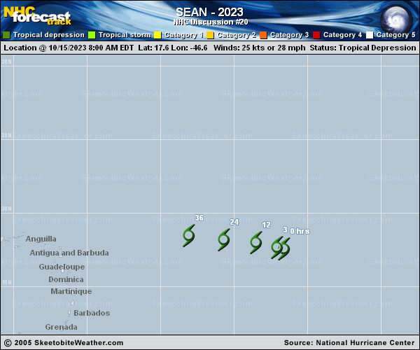
Copy of official data Tropical Depression Sean Discussion Number 20 NWS National Hurricane Center Miami FL AL192023 500 PM AST Sun Oct 15 2023 Sean continues to produce bursts of convection this afternoon to the south of the low-level center. An earlier scatterometer pass depicted that winds had weakened to 20-25 kt. Dvorak satellite intensity estimates continue to decrease as well with a T1.0/25 kt from TAFB this cycle. Using the previous scatterometer data and the current intensity estimate, the initial intensity remains 25 kt for this advisory. Sean continues to be resilient and produce convective bursts from time to time. The dry mid-level air has not been able to fully suppress the convection, even though the convection is becoming less organized. The convective pattern could become unorganized enough to no longer declare Sean a tropical cyclone soon. Model simulated satellite imagery continues to insist that the system will gradually decay and become devoid of convection. The NHC forecast is similar to the previous, with Sean forecast to become a post-tropical remnant low tonight, although the system may hold on until the circulation opens up into a trough in about 36 hours. The depression is moving west-northwestward with an estimated motion of 285/10 kt. As the system weakens and becomes vertically shallow, a turn more westward is forecast within the low-level steering flow. The NHC track is similar to the previous advisory and is near the corrected and simple consensus aids. FORECAST POSITIONS AND MAX WINDS INIT 15/2100Z 18.0N 48.2W 25 KT 30 MPH 12H 16/0600Z 18.2N 49.9W 25 KT 30 MPH...POST-TROP/REMNT LOW 24H 16/1800Z 18.4N 52.2W 20 KT 25 MPH...POST-TROP/REMNT LOW 36H 17/0600Z...DISSIPATED $$ Forecaster Kelly |