Official Discussion issued by the National Hurricane Center
Sean (AL192023) DATA RELEASED: 10/15/2023 3:00:00 PM UTC
|
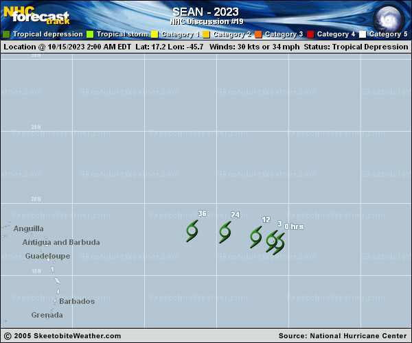
Copy of official data Tropical Depression Sean Discussion Number 19 NWS National Hurricane Center Miami FL AL192023 1100 AM AST Sun Oct 15 2023 Satellite imagery depicts that Sean has regained convection once again this morning. Visible imagery shows that the low-level center is displaced on the northern side of the recent convective burst. The latest Dvorak Current Intensity (CI) from TAFB is T2.0/30 kt, with the trend of the data-T numbers continuing to fall. A recent scatterometer pass indicated peak winds around 20-25 kt. Given the satellite-derived winds and lowering Data-T Dvorak intensity estimates, the initial intensity is lowered to 25 kt for this advisory. Sean continues to produce intermittent convective bursts as it remains in a low vertical wind shear environment over warm sea surface temperatures. However, dry mid-level air will eventually cause the convection to become less persistent and lose organization. As the system decays, Sean should become a remnant low, which could occur tonight. The NHC official forecast is similar to the previous, although it is also possible, that Sean remains a depression until the circulation opens up into a trough. The depression has turned west-northwest with an estimated motion of 290/9 kt. As the system weakens and becomes vertically shallow, a turn more westward is forecast within the low-level steering flow. The NHC track is similar to the previous advisory and is near the corrected and simple consensus aids. FORECAST POSITIONS AND MAX WINDS INIT 15/1500Z 17.7N 47.1W 25 KT 30 MPH 12H 16/0000Z 18.0N 48.5W 25 KT 30 MPH...POST-TROP/REMNT LOW 24H 16/1200Z 18.2N 50.7W 20 KT 25 MPH...POST-TROP/REMNT LOW 36H 17/0000Z 18.5N 53.1W 20 KT 25 MPH...POST-TROP/REMNT LOW 48H 17/1200Z...DISSIPATED $$ Forecaster Kelly |