Official Discussion issued by the National Hurricane Center
Katia (AL122023) DATA RELEASED: 9/4/2023 3:00:00 PM UTC
|
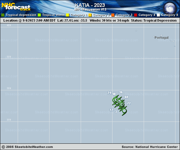
Copy of official data Tropical Depression Katia Discussion Number 13 NWS National Hurricane Center Miami FL AL122023 300 PM GMT Mon Sep 04 2023 Katia continues to produce small areas of convection well north of the center, but they aren't showing much organization. If the convective pattern does not improve, Katia will likely be declared a remnant low this evening. A partial scatterometer pass indicated maximum winds of 30 kt, so this will stay as the initial wind speed. The cyclone should gradually weaken in a moderate shear, low relative humidity environment, and this is indicated in the NHC forecast and all of the model guidance. The dry environment will likely cause Katia to become a remnant low soon, similar to the model simulated satellite forecasts. Katia is moving slower to the northwest, and should executive a slow clockwise loop over the next couple of days as its poleward motion is blocked by a low-level ridge. A steadier southward course should begin late Wednesday due to the ridge building to Katia's west. No notable changes were made to the intensity or track forecasts. FORECAST POSITIONS AND MAX WINDS INIT 04/1500Z 28.0N 34.0W 30 KT 35 MPH 12H 05/0000Z 28.4N 34.5W 25 KT 30 MPH...POST-TROP/REMNT LOW 24H 05/1200Z 28.6N 34.6W 25 KT 30 MPH...POST-TROP/REMNT LOW 36H 06/0000Z 28.6N 34.3W 20 KT 25 MPH...POST-TROP/REMNT LOW 48H 06/1200Z 28.1N 33.8W 20 KT 25 MPH...POST-TROP/REMNT LOW 60H 07/0000Z 27.2N 33.4W 20 KT 25 MPH...POST-TROP/REMNT LOW 72H 07/1200Z 26.0N 33.5W 20 KT 25 MPH...POST-TROP/REMNT LOW 96H 08/1200Z...DISSIPATED $$ Forecaster Blake |