Official Discussion issued by the National Hurricane Center
Eleven (AL112023) DATA RELEASED: 8/31/2023 3:00:00 AM UTC
|
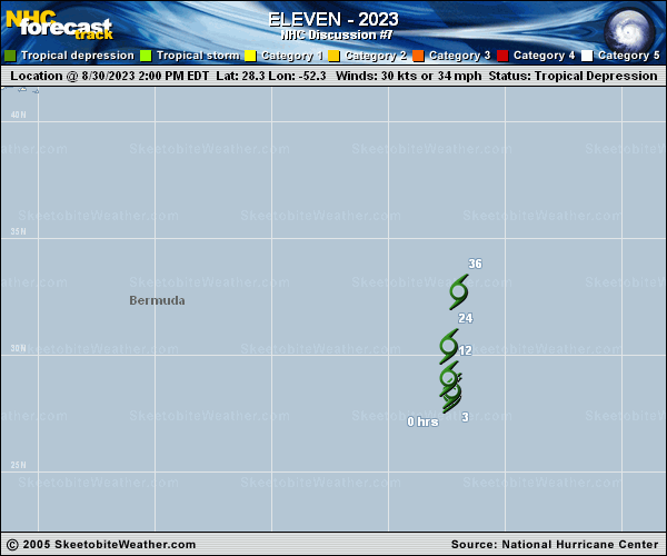
Copy of official data Tropical Depression Eleven Discussion Number 7 NWS National Hurricane Center Miami FL AL112023 1100 PM AST Wed Aug 30 2023 There has been a healthy burst of convection near the estimated low-level center this evening. Microwave satellite imagery shows some small curved bands on the eastern portion of the circulation. The initial intensity is held at 30 kt for this advisory, closest to the subjective Dvorak estimate from SAB. The depression continues to meander over the open waters of the central Atlantic. Model guidance predicts it will begin moving to the north soon, and gradually increase in forward speed over the next day or so between the flow of a subtropical ridge to its east and the flow around Hurricane Franklin to its west. Only minor adjustments have been made to latest official track forecast. There have also been no changes to the intensity forecast. Global models indicate the depression should lose deep, organized convection within a day or so, and the official forecast shows it becoming a remnant low in 36 h and dissipating by day 2. FORECAST POSITIONS AND MAX WINDS INIT 31/0300Z 28.5N 52.4W 30 KT 35 MPH 12H 31/1200Z 29.3N 52.5W 30 KT 35 MPH 24H 01/0000Z 31.3N 52.3W 30 KT 35 MPH 36H 01/1200Z 33.9N 51.9W 30 KT 35 MPH...POST-TROP/REMNT LOW 48H 02/0000Z...DISSIPATED $$ Forecaster Bucci |