Official Discussion issued by the National Hurricane Center
Isaac (AL102024) DATA RELEASED: 9/28/2024 9:00:00 PM UTC
|
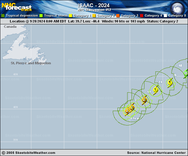
Copy of official data Hurricane Isaac Discussion Number 12 NWS National Hurricane Center Miami FL AL102024 900 PM GMT Sat Sep 28 2024 The expected weakening of Isaac appears to have started. The eye of the hurricane has been filling some during the past few hours, and the convective pattern is losing symmetry with dry air entraining into the southwestern side of the circulation. The Dvorak classifications are dropping, and accordingly, the initial intensity is nudged downward to 85 kt. The hurricane is already over cool 24 C waters and it is headed for progressively cooler waters during the next several days. These unfavorable oceanic conditions coupled with a sharp increase in vertical wind shear should cause steady weakening, and a transition into a post-tropical cyclone in about 36 hours. Isaac is moving relatively quickly northeastward at 16 kt. The system is forecast to move a little slower to the east-northeast or northeast during the next couple of days within the mid-latitude flow. After that, a turn to the north is expected on the eastern side of an extratropical low. No significant changes were made to the previous track forecast, and this one lies fairly close to the various consensus aids. FORECAST POSITIONS AND MAX WINDS INIT 28/2100Z 41.3N 38.4W 85 KT 100 MPH 12H 29/0600Z 42.5N 37.0W 75 KT 85 MPH 24H 29/1800Z 43.7N 35.1W 65 KT 75 MPH 36H 30/0600Z 44.8N 32.3W 55 KT 65 MPH...POST-TROPICAL 48H 30/1800Z 46.1N 30.0W 50 KT 60 MPH...POST-TROP/EXTRATROP 60H 01/0600Z 48.3N 28.2W 45 KT 50 MPH...POST-TROP/EXTRATROP 72H 01/1800Z 50.4N 27.4W 40 KT 45 MPH...POST-TROP/EXTRATROP 96H 02/1800Z 54.0N 26.5W 40 KT 45 MPH...POST-TROP/EXTRATROP 120H 03/1800Z 56.9N 23.6W 35 KT 40 MPH...POST-TROP/EXTRATROP $$ Forecaster Cangialosi |