Official Discussion issued by the National Hurricane Center
Six (AL062023) DATA RELEASED: 8/21/2023 3:00:00 AM UTC
|
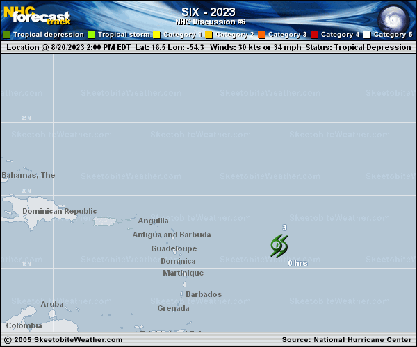
Copy of official data Tropical Depression Six Discussion Number 6 NWS National Hurricane Center Miami FL AL062023 1100 PM AST Sun Aug 20 2023 Proxy-vis satellite imagery indicates that the center of the depression remains exposed with convection displaced to the east. The system is also starting to be impacted by the outer rainbands of Tropical Storm Franklin. Based on a blend of objective and subjective satellite estimates, the initial intensity remains at 30 kt for this system. The depression remains in a strong deep-layer sheared environment, while also starting to be impacted by outer bands of Franklin. Models and simulated satellite data show the system becoming a remnant low overnight and dissipated in 24 hours. The depression is moving west-northwestward, and this general motion is expected to continue until dissipation occurs. The track forecast is very similar to the previous forecast, and lies near the consensus aids. FORECAST POSITIONS AND MAX WINDS INIT 21/0300Z 16.7N 55.7W 30 KT 35 MPH 12H 21/1200Z 16.8N 57.1W 25 KT 30 MPH...POST-TROP/REMNT LOW 24H 22/0000Z...DISSIPATED $$ Forecaster Kelly/Brown |