Official Discussion issued by the National Hurricane Center
Gert (AL062023) DATA RELEASED: 9/4/2023 3:00:00 AM UTC
|
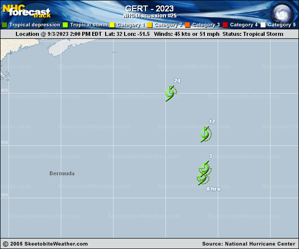
Copy of official data Tropical Storm Gert Discussion Number 25 NWS National Hurricane Center Miami FL AL062023 1100 PM AST Sun Sep 03 2023 The low-level center of Gert is exposed in proxy-visible satellite images tonight. Recent ASCAT-B wind retrievals indicate the surface center is becoming elongated and less defined. There are still tropical-storm-force winds occurring in the eastern semicircle, with scatterometer winds as high as 40-42 kt. However, this is more a product of Gert's translational speed than its paltry convective structure. Based on these data, the initial intensity is held at 45 kt for this advisory. Gert is moving quickly northward (010/19 kt) while being captured within the broader cyclonic flow associated with Post-Tropical Cyclone Idalia. Gert is forecast to accelerate northward to north-northwestward while it continues rounding the northeastern portion of Idalia's circulation. The global models show Gert becoming absorbed on Monday, and the updated NHC forecast predicts dissipation by 24 h. However, it is entirely possible that Gert opens into a trough even sooner based on its current structure. FORECAST POSITIONS AND MAX WINDS INIT 04/0300Z 35.4N 50.7W 45 KT 50 MPH 12H 04/1200Z 38.5N 52.3W 40 KT 45 MPH 24H 05/0000Z...DISSIPATED $$ Forecaster Reinhart |