Official Discussion issued by the National Hurricane Center
Gert (AL062023) DATA RELEASED: 9/3/2023 3:00:00 AM UTC
|
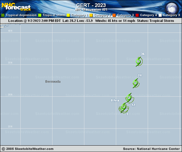
Copy of official data Tropical Storm Gert Discussion Number 21 NWS National Hurricane Center Miami FL AL062023 1100 PM AST Sat Sep 02 2023 Gert remains a resilient compact tropical storm in strong wind shear conditions and has even managed to strengthen a little more. The low-level center is partially exposed on the northeast side of the main area of deep convection. An ASCAT pass from around 00Z showed peak winds in the 45-50 kt range in the southeast quadrant, and based on that data, the initial wind speed is increased to 50 kt. This value is above the latest satellite intensity estimates. The tropical storm is moving north-northeastward at 5 kt. This motion with a gradual increase in forward speed is expected during the next day or so as the system gets swept up by the much larger circulation of Post-Tropical Cyclone Idalia. Most of the models show Gert dissipating in a day or so, and the NHC forecast has now moved up dissipation to 36 hours based on that guidance. FORECAST POSITIONS AND MAX WINDS INIT 03/0300Z 29.1N 53.4W 50 KT 60 MPH 12H 03/1200Z 30.7N 52.6W 50 KT 60 MPH 24H 04/0000Z 33.6N 51.9W 45 KT 50 MPH 36H 04/1200Z...DISSIPATED $$ Forecaster Cangialosi |