Official Discussion issued by the National Hurricane Center
Gert (AL062023) DATA RELEASED: 9/2/2023 9:00:00 PM UTC
|
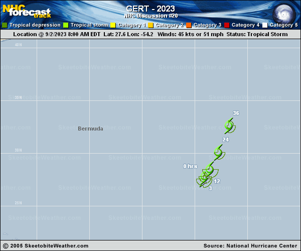
Copy of official data Tropical Storm Gert Discussion Number 20 NWS National Hurricane Center Miami FL AL062023 500 PM AST Sat Sep 02 2023 Satellite images indicate that Gert has become less organized since this morning. The low-level center is now exposed, with decreasing deep convection. Intensity estimates support keeping Gert at 45 kt for now, which remains near the UW-CIMSS SATCON value. The storm is finally moving at a more substantial pace, north- northeast at 8 kt, as it gets caught up in flow around Idalia to the west-northwest. Gert should continue to accelerate north- northeastward tonight and northward tomorrow around the eastern side of Idalia's large circulation. The global models remain consistent in showing the small circulation of Gert getting torn apart by Idalia on Monday, reminiscent of the way that Franklin took care of Jose yesterday. No substantial changes in intensity are expected as any decrease in organization should be roughly compensated by the large increase in forward. The new NHC track and intensity forecast are basically unchanged from the previous ones. FORECAST POSITIONS AND MAX WINDS INIT 02/2100Z 28.4N 53.8W 45 KT 50 MPH 12H 03/0600Z 29.8N 53.0W 40 KT 45 MPH 24H 03/1800Z 32.1N 52.0W 40 KT 45 MPH 36H 04/0600Z 35.5N 51.5W 40 KT 45 MPH 48H 04/1800Z...DISSIPATED $$ Forecaster Blake |