Official Discussion issued by the National Hurricane Center
Arlene (AL022023) DATA RELEASED: 6/2/2023 4:00:00 PM UTC
|
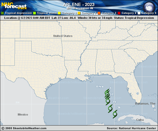
Copy of official data Tropical Storm Arlene Discussion Number 6 NWS National Hurricane Center Miami FL AL022023 400 PM CDT Fri Jun 02 2023 Arlene has changed little during the last few hours. The low-level center is still estimated to be near the southwest side of the main area of deep convection. The initial intensity remains 35 kt based on the earlier Hurricane Hunter data and a Dvorak 2.5 classification from TAFB. The tropical-storm-force winds are confined to a relatively small region of about 60 n mi to the north of the center in the area of strongest thunderstorms. Arlene is currently moving to the south-southeast at about 5 kt and is being steered by a mid- to upper-level trough that it is embedded within. This overall motion is expected to continue during the next day or two. Although Arlene has strengthened a little today, the models are in good agreement that increasing vertical wind shear and notably drier air are expected to affect the cyclone beginning tonight. These conditions should cause a weakening trend, and Arlene is expected to become a remnant low on Saturday and dissipate on Sunday. The main hazard expected from Arlene is the potential for heavy rain over portions of south and central Florida through Saturday. FORECAST POSITIONS AND MAX WINDS INIT 02/2100Z 26.4N 85.8W 35 KT 40 MPH 12H 03/0600Z 25.3N 85.6W 30 KT 35 MPH 24H 03/1800Z 24.0N 84.9W 25 KT 30 MPH...POST-TROP/REMNT LOW 36H 04/0600Z 23.2N 83.9W 20 KT 25 MPH...POST-TROP/REMNT LOW 48H 04/1800Z...DISSIPATED $$ Forecaster Cangialosi |