Official Discussion issued by the National Hurricane Center
Patty (AL172024) DATA RELEASED: 11/3/2024 9:00:00 PM UTC
|
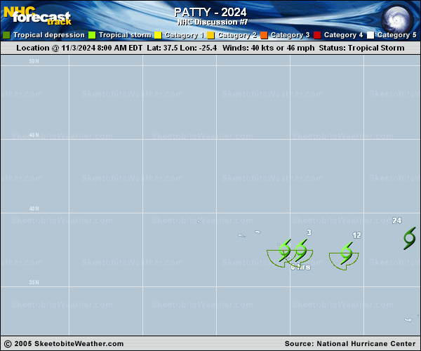
Copy of official data Subtropical Storm Patty Discussion Number 7 NWS National Hurricane Center Miami FL AL172024 900 PM GMT Sun Nov 03 2024 After being devoid of deep convection for much of the day, thunderstorms have reformed near the center of Patty. Therefore, Patty will hold its subtropical storm designation for now. The initial intensity is held at 40 kt in deference to the earlier scatterometer data. However, strong vertical wind shear, dry mid-latitude air, and cool sea surface temperatures should weaken Patty during the next couple of days. No changes have been made to the latest NHC intensity forecast. The storm is moving eastward at 15 kt and is forecast to move eastward to east-northeastward for the next couple of days. Patty is still expected to open into a trough near or over western Europe, and only minor adjustments have been made to the official track forecast. FORECAST POSITIONS AND MAX WINDS INIT 03/2100Z 37.3N 22.3W 40 KT 45 MPH 12H 04/0600Z 37.7N 19.0W 35 KT 40 MPH...POST-TROPICAL 24H 04/1800Z 38.9N 14.8W 30 KT 35 MPH...POST-TROP/REMNT LOW 36H 05/0600Z 40.2N 11.5W 30 KT 35 MPH...POST-TROP/REMNT LOW 48H 05/1800Z 41.2N 8.7W 25 KT 30 MPH...POST-TROP/REMNT LOW 60H 06/0600Z...DISSIPATED $$ Forecaster Bucci |