Official Discussion issued by the National Hurricane Center
Patty (AL172024) DATA RELEASED: 11/3/2024 3:00:00 PM UTC
|
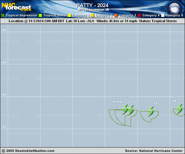
Copy of official data Subtropical Storm Patty Discussion Number 6 NWS National Hurricane Center Miami FL AL172024 300 PM GMT Sun Nov 03 2024 Patty is beginning to pull away from the Azores, with the center now just east of the easternmost islands. The storm is also on its way to becoming a post-tropical cyclone as deep convection has been absent for more than 6 hours. Recent ASCAT-A and ASCAT-B passes show peak winds in the 35-40 kt range, and based on that data and the degraded satellite appearance, the initial intensity is lowered to 40 kt. The strongest winds are occurring on the system's south side, just south of the easternmost Azores. Very strong westerly vertical wind shear, stable air, and cool waters should continue to cause weakening, and Patty will likely degenerate into a post-tropical cyclone in the next 6 to 12 hours. Dissipation has been moved up to 60 h based on the latest global model guidance. Patty is moving eastward at 14 kt in relatively zonal flow, and an eastward to east-northeastward toward western Europe is expected until the system dissipates. The NHC track forecast is near the middle of the guidance envelope. FORECAST POSITIONS AND MAX WINDS INIT 03/1500Z 37.5N 24.3W 40 KT 45 MPH 12H 04/0000Z 37.3N 21.2W 35 KT 40 MPH...POST-TROPICAL 24H 04/1200Z 38.3N 16.9W 30 KT 35 MPH...POST-TROP/REMNT LOW 36H 05/0000Z 39.7N 12.9W 30 KT 35 MPH...POST-TROP/REMNT LOW 48H 05/1200Z 40.8N 10.5W 25 KT 30 MPH...POST-TROP/REMNT LOW 60H 06/0000Z...DISSIPATED $$ Forecaster Cangialosi |