Official Discussion issued by the National Hurricane Center
(AL022024) DATA RELEASED: 7/10/2024 4:00:00 AM UTC
|
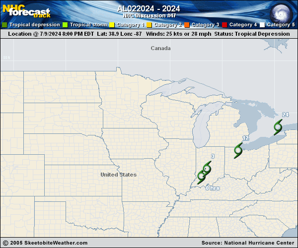
Copy of official data Post-Tropical Cyclone Beryl Discussion Number 47 NWS Weather Prediction Center College Park MD AL022024 400 AM CDT Wed Jul 10 2024 Key Messages: 1. Heavy rainfall will result in areas of flash flooding, some of which may be locally considerable, today into tonight from southeast Michigan into portions of central and northern New York and northern New England. 2. A few tornadoes are possible today, mainly over western and central New York. FORECAST POSITIONS AND MAX WINDS INIT 10/0900Z 40.9N 85.2W 25 KT 30 MPH...POST-TROPICAL 12H 10/1800Z 42.5N 82.5W 25 KT 30 MPH...POST-TROP/INLAND 24H 11/0600Z 44.3N 78.9W 25 KT 30 MPH...POST-TROP/INLAND 36H 11/1800Z 46.0N 74.8W 20 KT 25 MPH...POST-TROP/INLAND $$ Forecaster Chenard/Dolan |