Official Discussion issued by the National Hurricane Center
Leslie (AL132024) DATA RELEASED: 10/12/2024 3:00:00 AM UTC
|
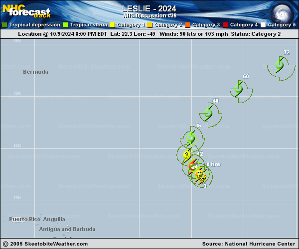
Copy of official data Tropical Storm Leslie Discussion Number 39 NWS National Hurricane Center Miami FL AL132024 1100 PM AST Fri Oct 11 2024 Convection associated with Leslie has been increasing during the past several hours as the cyclone moves into an area of temporarily decreased shear. A recent ASCAT overpass showed winds of 40-45 kt in the southeastern quadrant, and based on these data the initial intensity is held at 45 kt. The scatterometer data also suggest that the circulation is becoming somewhat distorted due to the rapid northeastward motion. The initial motion is now 035/19 kt. The cyclone is accelerating northeastward as it moves into the mid-latitude southwesterly flow to the east of a deep-layer trough over the northwestern Atlantic. This general motion should continue for 24 h or so. After that, Leslie or its remnants should turn eastward and east-southeastward on the southwestern side of another deep-layer trough located over the northeastern Atlantic, with this motion continuing until the system dissipates. There are no significant changes in the track guidance since the previous advisory, and the new forecast track is similar to the previous track. Shear over Leslie should remain relatively low for the next 12-18 h, allowing the current convection to continue and the system to maintain tropical cyclone status during that time. The global models have come into good agreement that Leslie will merge with a frontal system to become extratropical between 24-36 h, and thus the intensity forecast status has been adjusted accordingly. The extratropical cyclone should subsequently weaken and be absorbed into the larger system over the eastern Atlantic by 96 h. It should be noted that while the models show a closed low pressure area through 72 h, the circulation could degenerate into an open trough before then due to the fast forward speed. FORECAST POSITIONS AND MAX WINDS INIT 12/0300Z 29.3N 47.9W 45 KT 50 MPH 12H 12/1200Z 31.8N 45.0W 45 KT 50 MPH 24H 13/0000Z 34.8N 39.5W 45 KT 50 MPH 36H 13/1200Z 36.7N 33.6W 40 KT 45 MPH...POST-TROP/EXTRATROP 48H 14/0000Z 37.1N 28.3W 35 KT 40 MPH...POST-TROP/EXTRATROP 60H 14/1200Z 36.0N 23.5W 35 KT 40 MPH...POST-TROP/EXTRATROP 72H 15/0000Z 35.3N 19.2W 30 KT 35 MPH...POST-TROP/EXTRATROP 96H 16/0000Z...DISSIPATED $$ Forecaster Beven |