Official Discussion issued by the National Hurricane Center
Chris (AL032024) DATA RELEASED: 7/1/2024 4:00:00 AM UTC
|
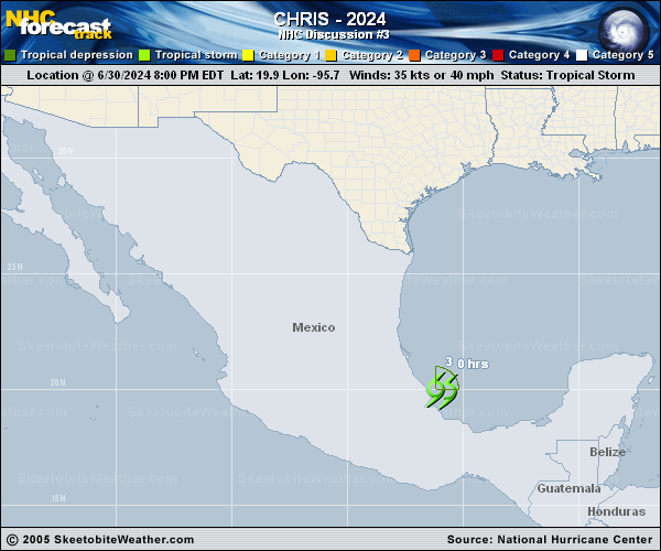
Copy of official data Tropical Storm Chris Discussion Number 3 NWS National Hurricane Center Miami FL AL032024 400 AM CDT Mon Jul 01 2024 Around 0450 UTC, Chris is estimated to have made landfall near Lechuguillas in the Mexican state of Veracruz. Since then, satellite infrared imagery showed an increase in the thunderstorm activity in the eastern portion of the circulation, near the region of the radius of maximum wind which is still over the Bay of Campeche. Therefore, the initial intensity is held at 35 kt for this advisory. Chris should weaken quickly throughout the day as the system moves just north of west at an estimated 280/10 kt inland over eastern Mexico. Simulated satellite data from global models suggest Chris will dissipate over the higher terrain later today and the official forecast now shows dissipation occuring by 12 h, if not sooner. Key messages: 1. Heavy rainfall will result in areas of flooding across portions of eastern Mexico this morning, with mudslides possible in areas of higher terrain. 2. Tropical-storm-force winds are expected for the next few hours in the tropical storm warnings area in Mexico. FORECAST POSITIONS AND MAX WINDS INIT 01/0900Z 20.1N 97.2W 35 KT 40 MPH 12H 01/1800Z...DISSIPATED $$ Forecaster Bucci |