Official Discussion issued by the National Hurricane Center
Kirk (AL122024) DATA RELEASED: 10/6/2024 3:00:00 PM UTC
|
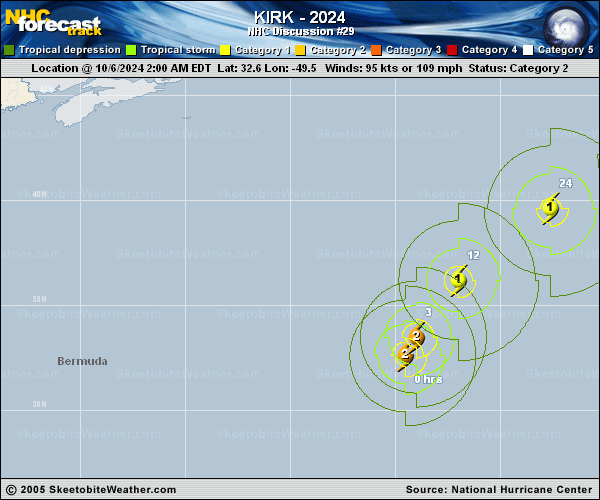
Copy of official data Hurricane Kirk Discussion Number 29 NWS National Hurricane Center Miami FL AL122024 1100 AM AST Sun Oct 06 2024 Most of Kirk's convection is now located in its northeastern semicircle as a result of increasing southwesterly vertical wind shear over the cyclone. Satellite intensity estimates continue to decrease, with the latest subjective estimates from TAFB and SAB at T-4.5/77 kt. Some of the objective CIMSS intensity estimates are still a bit higher, and the initial intensity is set to 85 kt, in agreement with the objective estimates. Kirk is expected to continue to weaken during the next several days due to strong southwesterly wind shear, which is expected to increase even more after 24 h. Also, the hurricane will reach cooler sea-surface temperature below 26C in about 12 hours. Global models indicate that Kirk should undergo extratropical transition soon, and the transition should be complete in about 36 h. Kirk's wind field is expected to remain quite large, which will continue to generate a very large area of dangerous seas over the Atlantic. The NHC intensity forecast is similar to the previous prediction and lies near the middle of the guidance. Kirk is moving toward the north-northeast, or 020/22 kt within the flow between an eastern Atlantic subtropical ridge and a deep-layer trough to the west of Kirk. The track guidance continues to be in fairly good agreement that Kirk will accelerate while turning northeastward and east-northeastward over the next couple of days. The NHC forecast is close to the previous prediction, and shows Kirk passing north of the Azores Monday night and Tuesday as an extratropical cyclone, then moving over portions of western Europe Wednesday afternoon through Thursday. Large swells from Kirk are propagating far away from the hurricane and bringing an increased risk of dangerous surf and rip currents to portions of the Leeward Islands, the Greater Antilles, the Bahamas, Bermuda, the U.S. East Coast, and Atlantic Canada. These swells are expected to spread toward the Azores on Monday. For more information on this hazard, see products issued by your local weather office. The initial wind radii have been increased based on data from a recent ASCAT pass. FORECAST POSITIONS AND MAX WINDS INIT 06/1500Z 35.6N 47.7W 85 KT 100 MPH 12H 07/0000Z 38.1N 45.1W 75 KT 85 MPH 24H 07/1200Z 41.1N 39.9W 70 KT 80 MPH 36H 08/0000Z 43.1N 33.3W 60 KT 70 MPH...POST-TROP/EXTRATROP 48H 08/1200Z 43.8N 25.2W 55 KT 65 MPH...POST-TROP/EXTRATROP 60H 09/0000Z 44.5N 15.6W 50 KT 60 MPH...POST-TROP/EXTRATROP 72H 09/1200Z 46.7N 6.0W 45 KT 50 MPH...POST-TROP/EXTRATROP 96H 10/1200Z 52.5N 9.0E 35 KT 40 MPH...POST-TROP/EXTRATROP 120H 11/1200Z...DISSIPATED $$ Forecaster Hagen |