Official Discussion issued by the National Hurricane Center
(AL092024) DATA RELEASED: 9/27/2024 4:00:00 PM UTC
|
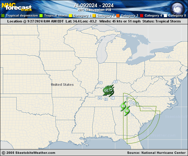
Copy of official data Post-Tropical Cyclone Helene Discussion Number 18 NWS National Hurricane Center Miami FL AL092024 400 PM CDT Fri Sep 27 2024 Helene has been producing catastrophic flooding over portions of the southeast U.S. and southern Appalachians, and the associated heavy rains are shifting westward into the Ohio and Tennessee Valleys. Satellite images and surface observations indicate that Helene has completed extratropical transition, and the initial intensity is set at 30 kt. The cyclone is moving to the north-northwest at 15 kt. A slowdown is expected tonight, and the cyclone is forecast to stall over the Tennessee Valley this weekend, likely resulting in continued and prolonged rainfall. This is the last tropical cyclone discussion issued by the National Hurricane Center on Helene. Future information on this system can be found in discussions issued by the Weather Prediction Center beginning at 1000 PM CDT, under AWIPS header TCDAT4, WMO header WTNT44 KWNH, and on the web at www.hurricanes.gov. Rainfall forecasts for the United States can always be found at https://www.wpc.ncep.noaa.gov/qpf/qpf2.shtml and outlooks of flash flood risks can be found at https://www.wpc.ncep.noaa.gov/qpf/excessive_rainfall_outlook_ero.php . KEY MESSAGES: 1. Historic, catastrophic and life-threatening flash and urban flooding, including numerous major landslides, will continue across portions of the southern Appalachians through this evening, followed by gradual improvement tonight and into Saturday. Widespread serious river flooding is ongoing, some of which will be major to record breaking. 2. There is a possibility of long-duration power outages in portions of the southeast U.S. If you use a generator, be sure it is placed outside at least 20 feet away from doors, windows, and garages to avoid deadly carbon monoxide poisoning. 3. Use caution after the system passes as deadly hazards remain including downed power lines and flooded areas. FORECAST POSITIONS AND MAX WINDS INIT 27/2100Z 37.5N 85.5W 30 KT 35 MPH...POST-TROPICAL 12H 28/0600Z 37.9N 87.0W 25 KT 30 MPH...POST-TROP/EXTRATROP 24H 28/1800Z 37.7N 87.2W 20 KT 25 MPH...POST-TROP/EXTRATROP 36H 29/0600Z 37.5N 87.3W 20 KT 25 MPH...POST-TROP/EXTRATROP 48H 29/1800Z 37.3N 87.0W 20 KT 25 MPH...POST-TROP/EXTRATROP 60H 30/0600Z...DISSIPATED $$ Forecaster Cangialosi |