Official Discussion issued by the National Hurricane Center
(AL062024) DATA RELEASED: 9/12/2024 4:00:00 PM UTC
|
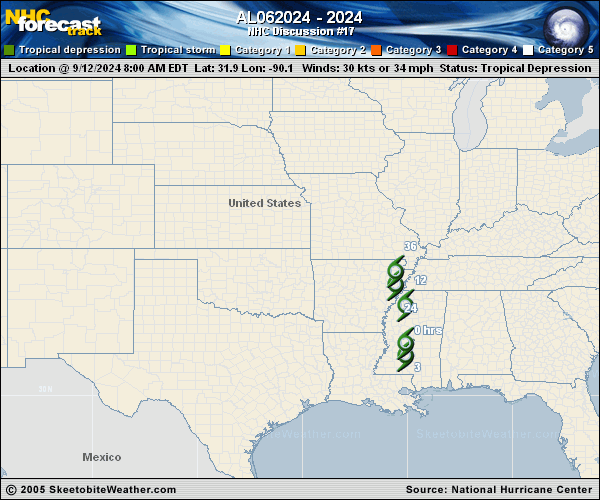
Copy of official data Post-Tropical Cyclone Francine Discussion Number 17 NWS Weather Prediction Center College Park MD AL062024 400 PM CDT Thu Sep 12 2024 KEY MESSAGES: 1. Francine will continue to bring heavy rainfall and the risk of flash and urban flooding, along with river flooding, across portions of the Lower Mississippi Valley, Tennessee Valley and the Southeast. Considerable flash and urban flooding is possible through tonight over portions of Alabama and the Florida Panhandle, expanding into Georgia and middle Tennessee Friday. 2. A few tornadoes are possible through this evening across the Florida Panhandle, southern and central Alabama, and southwest Georgia. FORECAST POSITIONS AND MAX WINDS INIT 12/2100Z 33.8N 89.8W 20 KT 25 MPH...POST-TROPICAL 12H 13/0600Z 35.1N 90.1W 20 KT 25 MPH...POST-TROP/EXTRATROP 24H 13/1800Z 35.9N 90.5W 15 KT 15 MPH...POST-TROP/EXTRATROP 36H 14/0600Z...DISSIPATED $$ Forecaster Taylor/Lamers |