Official Discussion issued by the National Hurricane Center
Helene (AL092024) DATA RELEASED: 9/27/2024 9:00:00 AM UTC
|
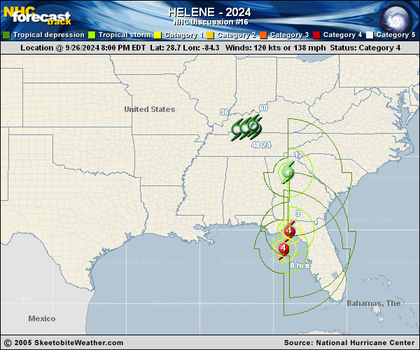
Copy of official data Tropical Storm Helene Discussion Number 16 NWS National Hurricane Center Miami FL AL092024 500 AM EDT Fri Sep 27 2024 The eye of Helene made landfall near Perry, Florida, just after the last advisory was issued. Since then, the center has crossed the Florida Big Bend region and is currently located over east central Georgia. Surface observations have shown steady weakening since landfall, and the maximum winds have decreased to a possibly generous 60 kt. During the last couple of hours, the radar signature of the cyclone has degraded, and based on this the hourly Tropical Cyclone Updates will be discontinued. The initial motion is now northward or 360/26. Helen should turn northwestward later today as it starts to interact with a mid- to upper-level baroclinic low to its northwest. After that, the cyclone should considerably slow its forward motion and make a cyclonic loop as it gets absorbed into the low. The new forecast track follows the general trend of the large-scale dynamical models. Helene should continue to weaken, and simulated satellite imagery suggests it should lose its convection later today, the new intensity forecast calls for the cyclone to weaken and become post-tropical in about 12 h, followed by transition to an extratropical cyclone as it merges with the baroclinic low. The remnant extratropical low is expected to dissipate by 72 h. Although the system will weaken as it moves over land, the fast forward speed of Helene during the next 12 hours or so will result in a far inland penetration of strong winds over parts of the southeastern United States, particularly over northern Georgia, including strong gusts over the higher terrain of the southern Appalachians. Accordingly, a higher-than-normal gust factor is indicated in the official forecast while Helene is inland. KEY MESSAGES: 1. The storm surge along portions of the Florida Big Bend coast and other portions of the west coast of Florida should subside today. 2. Damaging wind gusts will continue to penetrate well inland over portions of Georgia and the Carolinas today, particularly over the higher terrain of the southern Appalachians. Residents in these areas should be prepared for the possibility of long-duration power outages. If you use a generator after the storm, be sure it is placed outside at least 20 feet away from doors, windows, and garages to avoid deadly carbon monoxide poisoning. 3. Catastrophic and life-threatening flash and urban flooding, including numerous significant landslides, is expected across portions of the southern Appalachians through Friday. Considerable to locally catastrophic flash and urban flooding is likely for northwestern and northern Florida and the Southeast through Friday. Widespread significant river flooding is likely, some of which will be major to record breaking. FORECAST POSITIONS AND MAX WINDS INIT 27/0900Z 32.8N 83.0W 60 KT 70 MPH...INLAND 12H 27/1800Z 36.4N 84.5W 35 KT 40 MPH...POST-TROP/INLAND 24H 28/0600Z 36.9N 87.3W 30 KT 35 MPH...POST-TROP/EXTRATROP 36H 28/1800Z 36.7N 87.3W 25 KT 30 MPH...POST-TROP/EXTRATROP 48H 29/0600Z 36.7N 87.0W 20 KT 25 MPH...POST-TROP/EXTRATROP 60H 29/1800Z 36.9N 86.0W 20 KT 25 MPH...POST-TROP/EXTRATROP 72H 30/0600Z...DISSIPATED $$ Forecaster Beven |