Official Discussion issued by the National Hurricane Center
Kirk (AL122024) DATA RELEASED: 10/3/2024 UTC
|
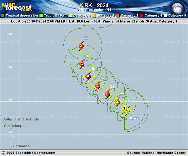
Copy of official data Hurricane Kirk Special Discussion Number 14 NWS National Hurricane Center Miami FL AL122024 800 PM AST Wed Oct 02 2024 Kirk is undergoing rapid intensification this evening. Geostationary satellite imagery has shown an eye clearing and Dvorak estimates are rising as quickly as they are allowed. The initial intensity is set to a possibly conservative 105 kt, closest to the final-T number (T5.5) from TAFB. The intensity forecast has been increased between 12 through 48 h. No changes were made to the intensity forecast beyond 60 h, or the track and wind radii predictions. The next forecast will be released at the normally scheduled time (11 PM AST). FORECAST POSITIONS AND MAX WINDS INIT 03/0000Z 19.3N 44.3W 105 KT 120 MPH 12H 03/0600Z 19.9N 45.1W 120 KT 140 MPH 24H 03/1800Z 21.1N 46.6W 125 KT 145 MPH 36H 04/0600Z 22.4N 48.1W 125 KT 145 MPH 48H 04/1800Z 23.8N 49.5W 115 KT 130 MPH 60H 05/0600Z 25.7N 50.5W 110 KT 125 MPH 72H 05/1800Z 28.5N 50.6W 105 KT 120 MPH 96H 06/1800Z 35.1N 47.9W 90 KT 105 MPH 120H 07/1800Z 42.5N 38.0W 80 KT 90 MPH $$ Forecaster Bucci/Cangialosi |