Official Discussion issued by the National Hurricane Center
Kirk (AL122024) DATA RELEASED: 10/2/2024 3:00:00 AM UTC
|
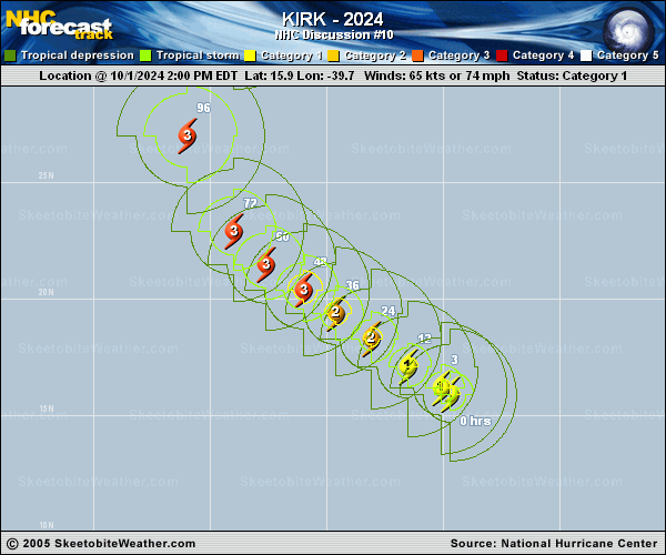
Copy of official data Hurricane Kirk Discussion Number 10 NWS National Hurricane Center Miami FL AL122024 1100 PM AST Tue Oct 01 2024 Kirk has stopped its strengthening trend for the moment. Geostationary satellite imagery has shown a large primary band extending around the northern and eastern portions of the circulation, with a dry air intrusion making its way into the inner core. An SSMIS microwave pass from 1915 UTC showed that the eyewall was open to the southwest. The initial intensity is held at 65 kt, closest to the subjective Dvorak estimate from TAFB. The hurricane is moving northwestward at 11 kt. A subtropical ridge should continue to steer Kirk in the same general direction through Thursday. By the end of the week, a trough exiting the eastern U.S. seaboard should weaken the ridge and turn Kirk northward, followed by a turn to the north-northeast over the weekend. The track guidance is tightly clustered and only minor updates have been made to the latest NHC track forecast. Kirk is expected to continue strengthening in the coming days. Global models forecast the deep-layer vertical wind shear to remain weak and warm sea surface temperatures along the forecast track during the next few days. The vertical wind shear is predicted to gradually increase over the weekend and will likely induce a weakening trend by the end of the forecast period. The latest NHC intensity forecast is unchanged from the previous advisory and now lies at the upper-end of the guidance envelope, closest to HCCA. As mentioned earlier, Kirk is a large system and expected to grow larger as it moves northward, with tropical-storm-force winds extending far from the center. FORECAST POSITIONS AND MAX WINDS INIT 02/0300Z 16.7N 40.8W 65 KT 75 MPH 12H 02/1200Z 17.6N 42.2W 75 KT 85 MPH 24H 03/0000Z 18.7N 43.6W 85 KT 100 MPH 36H 03/1200Z 19.8N 45.0W 95 KT 110 MPH 48H 04/0000Z 21.0N 46.5W 100 KT 115 MPH 60H 04/1200Z 22.3N 48.0W 105 KT 120 MPH 72H 05/0000Z 24.0N 49.3W 110 KT 125 MPH 96H 06/0000Z 28.8N 50.1W 110 KT 125 MPH 120H 07/0000Z 35.3N 46.4W 95 KT 110 MPH $$ Forecaster Bucci |