Official Discussion issued by the National Hurricane Center
(AL062024) DATA RELEASED: 9/8/2024 4:00:00 PM UTC
|
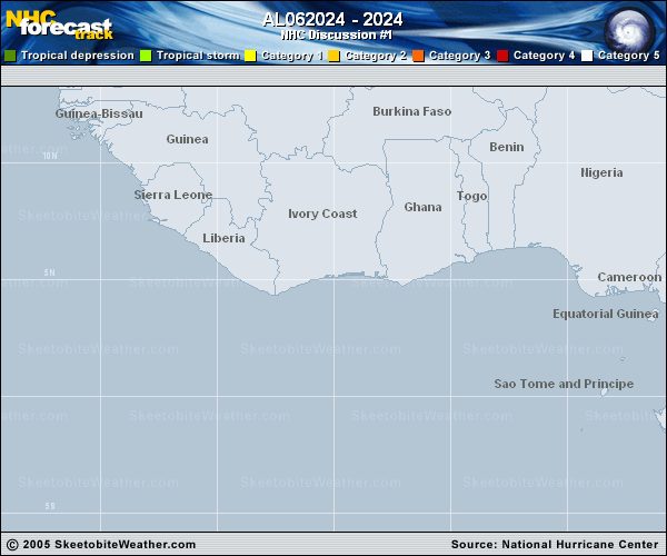
Copy of official data Potential Tropical Cyclone Six Discussion Number 1 NWS National Hurricane Center Miami FL AL062024 400 PM CDT Sun Sep 08 2024 The area of disturbed weather located over the southwestern Gulf of Mexico does not possess a well-defined circulation yet. Scatterometer and aircraft data indicate that it consists of an elongated trough of low pressure oriented north-northwest to south-southeast. However, there is a large area of 35-45 kt winds located southwest of the trough axis. These tropical-storm-force winds are also confirmed by an ongoing Air Force Reserve reconnaissance mission, which found 975 mb flight-level winds up to 56 kt, with SFMR winds also quite high in the same vicinity. Some of these high winds are likely enhanced in part due to a barrier jet offshore of the Sierra Madre mountains of Mexico. Because the system is expected to become a tropical storm over the next day or so, and tropical-storm-force winds are forecast to be near the coast of Mexico within 48 hours, advisories are being initiated on Potential Tropical Cyclone Six. The initial intensity is set to 45 kt for this advisory based on a blend of scatterometer and aircraft data. The initial motion is highly uncertain given the fact that a well-defined center does not yet exist, but our best estimate is 320/4 kt. The track guidance shows this slow northwest drift continuing, though the center could reform or redevelop anywhere along the current trough axis as the center becomes better defined. Afterwards, the system is expected to turn northward and then north-northeastward as it rounds the periphery of a mid-level ridge centered over Cuba. The track guidance this cycle shifted east, with the GFS and ECMWF models notably on the east side of the guidance envelope. The initial NHC track forecast won't go quite that far east, but splits the difference between the consensus aid TVCN and these eastward model solutions. Future adjustments could be necessary if these eastward trends continue. Given the current structure, the track forecast is of lower confidence than usual. Given that the current circulation is quite elongated, it will likely take a day or even longer for intensification to begin, and much of the wind enhancement on its southwestern side is more of a reflection of a barrier jet rather than the true intensity of the stretched out vorticity maxima. Both the global model and hurricane-regional model guidance suggest the circulation will become well-defined by tomorrow afternoon, and the NHC intensity forecast shows the system becoming a tropical storm by that time. Until then, the intensity guidance, especially the statistical-dynamical guidance SHIPS and LGEM, likely show too much short-term intensification because these tools are designed for tropical cyclones and not elongated troughs. The hurricane-regional models HAFS-A/B seem to have a fairly realistic depiction of the system's current structure, and show little intensification for the next 36 h or so. Afterwards, as they depict the center becoming well-defined with contracting wind radii, they show more significant intensification. Between 48-72 h, PTC Six could interact with an upper-level trough centered over Texas, and its intensity as it approaches the Texas and Louisiana Gulf Coast will be governed by its inner-core structure and if it undergoes a favorable trough interaction. This initial forecast shows the system becoming a hurricane just before landfall. KEY MESSAGES: 1. The system is forecast to become a tropical storm on Monday as it moves northwestward to northward near or along the western Gulf of Mexico coast. Tropical Storm Watches have been issued for a portion of northeastern Mexico and additional watches may be needed for the southern Texas coast tonight. 2. The system is forecast to become a hurricane before it reaches the northwestern Gulf Coast by the middle of the week. While it is too soon to pinpoint the exact location and magnitude of impacts, the potential for life-threatening storm surge and damaging winds are increasing for portions of the Upper Texas and Louisiana coastlines beginning Tuesday night. Hurricane and Storm Surge Watches will likely be issued for a portion of that area on Monday, and residents should ensure they have their hurricane plan in place. 3. Potential Tropical Cyclone Six is expected to bring heavy rainfall and the risk of flash flooding from the coast of far northeast Mexico into portions of coastal Texas and Louisiana through Thursday. FORECAST POSITIONS AND MAX WINDS INIT 08/2100Z 21.6N 94.6W 45 KT 50 MPH...POTENTIAL TROP CYCLONE 12H 09/0600Z 22.3N 95.1W 45 KT 50 MPH...POTENTIAL TROP CYCLONE 24H 09/1800Z 23.2N 95.7W 45 KT 50 MPH...TROPICAL CYCLONE 36H 10/0600Z 24.3N 96.0W 45 KT 50 MPH 48H 10/1800Z 25.5N 96.1W 55 KT 65 MPH 60H 11/0600Z 27.0N 95.7W 60 KT 70 MPH 72H 11/1800Z 29.0N 94.1W 65 KT 75 MPH 96H 12/1800Z 33.6N 91.4W 30 KT 35 MPH...POST-TROP/INLAND 120H 13/1800Z 37.0N 89.9W 25 KT 30 MPH...POST-TROP/EXTRATROP $$ Forecaster Papin |