|
HURRICANE RELIEF:
1-800-HELP-NOW
AMERICAN
RED CROSS

Click here to view the Forecast/Discussion archive for this storm
Post-Tropical Cyclone Katia Discussion Number  14
NWS National Hurricane Center Miami FL       AL122023
900 PM GMT Mon Sep 04 2023

The convection clock has run out on Katia with no organized
thunderstorm activity for most of the day.  No additional organized
convection is expected either due to very dry air aloft and
continued shear. Thus, the system is declared post-tropical, and
this is the last NHC advisory. The winds are set to 30 kt in
accordance with an earlier scatterometer pass.

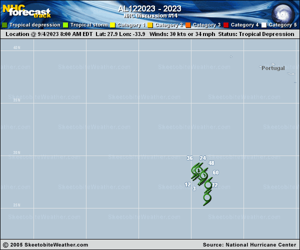
Katia isn't moving much now, and it is forecast to drift in a small
clockwise loop over the next day or two within the subtropical
ridge.  The remnants of the system should move a bit faster
southward on Wednesday, gradually weakening due to the unfavorable
environment, and open up into a trough within 3 days.

Additional information on this system can be found in High Seas
Forecasts issued by Meteo France under WMO header FQNT50 LFPW and
available on the web at
www.meteofrance.com/previsions-meteo-marine/bulletin/grandlarge/
metarea2.


FORECAST POSITIONS AND MAX WINDS

INIT  04/2100Z 28.0N  34.4W   30 KT  35 MPH...POST-TROP/REMNT LOW
12H  05/0600Z 28.2N  34.7W   25 KT  30 MPH...POST-TROP/REMNT LOW
24H  05/1800Z 28.4N  34.5W   25 KT  30 MPH...POST-TROP/REMNT LOW
36H  06/0600Z 28.1N  34.2W   25 KT  30 MPH...POST-TROP/REMNT LOW
48H  06/1800Z 27.5N  33.7W   20 KT  25 MPH...POST-TROP/REMNT LOW
60H  07/0600Z 26.5N  33.5W   20 KT  25 MPH...POST-TROP/REMNT LOW
72H  07/1800Z...DISSIPATED

$$
Forecaster Blake
 |