|
HURRICANE RELIEF:
1-800-HELP-NOW
AMERICAN
RED CROSS

Click here to view the Forecast/Discussion archive for this storm
Post-Tropical Cyclone Emily Discussion Number   5
NWS National Hurricane Center Miami FL       AL072023
1100 AM AST Mon Aug 21 2023

Emily has been devoid of deep convection for nearly 15 hours and no
longer meets the definition of a tropical cyclone. Although sea
surface temperatures are sufficiently warm to support occasional
bursts of convection, strong wind shear and a very dry environment
should prevent it from re-organizing as a tropical cyclone for at
least the next couple days. The initial intensity of 30 kt is based
on ASCAT-B data valid at 1200 UTC.

In about 3 days, the remnant low is forecast to turn northward as it
encounters a deep-layer trough over the central Atlantic. While it
turns, Emily could briefly encounter a more favorable upper-level
wind pattern, which could support the redevelopment of convection.
However, the low-level center may also become stretched and
ill-defined at the same time. Regeneration as a tropical cyclone
does not appear likely enough to explicitly forecast it at this
time. Information on the potential for regeneration will be included
in future Tropical Weather Outlooks, if necessary. Future
information on Emily can also be found in High Seas forecasts issued
by the National Hurricane Center and Ocean Prediction Center.


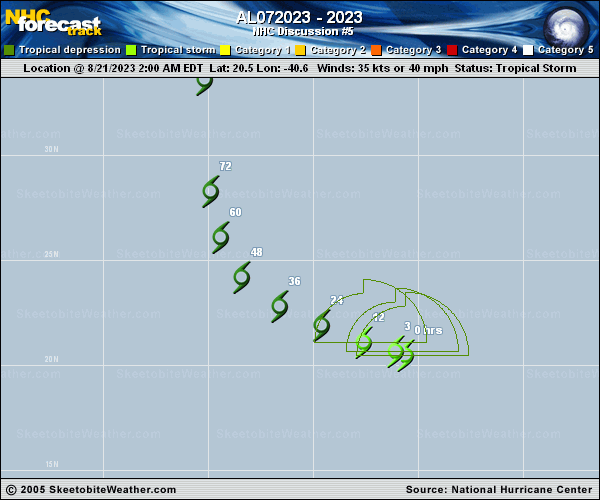
FORECAST POSITIONS AND MAX WINDS

INIT  21/1500Z 21.1N  41.9W   30 KT  35 MPH...POST-TROP/REMNT LOW
12H  22/0000Z 21.6N  43.4W   30 KT  35 MPH...POST-TROP/REMNT LOW
24H  22/1200Z 22.5N  45.5W   30 KT  35 MPH...POST-TROP/REMNT LOW
36H  23/0000Z 23.6N  47.4W   30 KT  35 MPH...POST-TROP/REMNT LOW
48H  23/1200Z 25.2N  48.8W   30 KT  35 MPH...POST-TROP/REMNT LOW
60H  24/0000Z 27.1N  49.5W   30 KT  35 MPH...POST-TROP/REMNT LOW
72H  24/1200Z 29.5N  49.7W   30 KT  35 MPH...POST-TROP/REMNT LOW
96H  25/1200Z...DISSIPATED

$$
Forecaster D. Zelinsky
 |