Official Discussion issued by the National Hurricane Center
(AL202020) DATA RELEASED: 9/23/2020 9:00:00 AM UTC
|
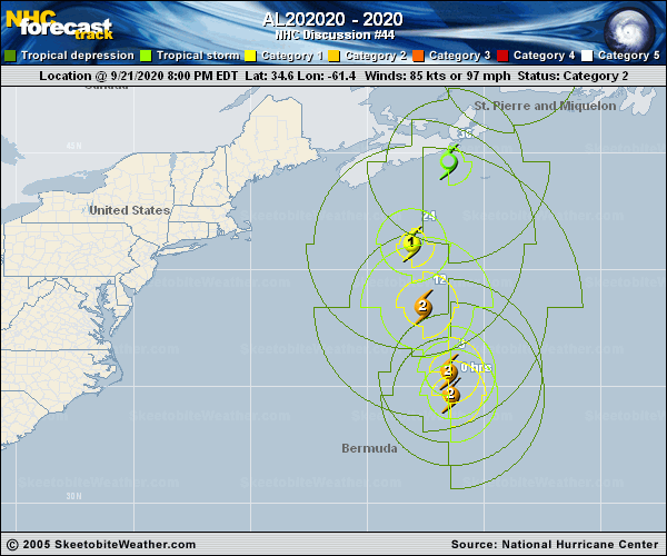
Copy of official data Post-Tropical Cyclone Teddy Discussion Number 44 NWS National Hurricane Center Miami FL AL202020 500 AM AST Wed Sep 23 2020 Teddy's deep convection has been diminishing, but based on buoy observations the cyclone still has a strong circulation with a central pressure in the 950's. Assuming a gradual spindown of the system since the earlier aircraft observations, the estimated maximum winds have dropped to just below hurricane strength. The system is expected to traverse Nova Scotia today as a strong extratropical cyclone, and move near Newfoundland by tonight. After passing east of Labrador on Thursday, the global models show Teddy merging with another large extratropical low over the north Atlantic. The estimated initial motion is north-northeastward or 025/20 kt. Teddy is embedded within a deep-layer trough that is located in the vicinity of Atlantic Canada. The post-tropical cyclone should move north-northeastward on the eastern side of the trough for the next 36-48 hours before it merges with the other low. The official track forecast is very similar to the previous one and also closely follows the corrected multi-model consensus, HCCA. Even after Teddy passes Nova Scotia and Newfoundland, large swells will linger over much of the southwestern Atlantic basin for the next few days. Key Messages: 1. Teddy is expected remain a powerful post-tropical cyclone while it moves near or over portions of Atlantic Canada through tonight. The most significant hazard expected from Teddy is large destructive waves forecast along the southern coast of Nova Scotia today. 2. Very large swells produced by Teddy are expected to affect portions of Bermuda, the Leeward Islands, the Greater Antilles, the Bahamas, the east coast of the United States, and Atlantic Canada during the next few days. These swells are expected to cause life-threatening surf and rip current conditions. 3. Tropical Storm Watches and Warnings are in effect for portions of Nova Scotia, Newfoundland, Prince Edward Island and the Magdalen Islands, and heavy rainfall across Atlantic Canada is expected through Thursday. FORECAST POSITIONS AND MAX WINDS INIT 23/0900Z 44.5N 62.7W 60 KT 70 MPH...POST-TROP/EXTRATROP 12H 23/1800Z 47.5N 60.6W 55 KT 65 MPH...POST-TROP/EXTRATROP 24H 24/0600Z 52.3N 56.7W 45 KT 50 MPH...INLAND 36H 24/1800Z 57.0N 53.5W 40 KT 45 MPH...POST-TROP/EXTRATROP 48H 25/0600Z...POST-TROP/EXTRATROP $$ Forecaster Pasch |