Official Discussion issued by the National Hurricane Center
Teddy (AL202020) DATA RELEASED: 9/16/2020 9:00:00 AM UTC
|
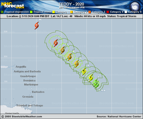
Copy of official data Hurricane Teddy Discussion Number 16 NWS National Hurricane Center Miami FL AL202020 500 AM AST Wed Sep 16 2020 Teddy continues to quickly intensify. The latest satellite images shows that a ragged eye is present, although microwave images show it is closed in the low-levels. Satellite intensity estimates earlier were between 77- 90 kt, and the initial wind speed is set to 85 with the increasing organization. The environment appears to be ripe for rapid intensification with light shear, warm water, and a solid ring present on overnight 37 GHz microwave data. Thus a 30-kt wind increase will be forecast for the first 24 hours from the 6Z initial wind speed of 80 kt. After that time, there could be an increase in shear from the mid-oceanic trough, which should level off the wind speed, along with possibly an increase in mid-level dry air. At long range, Teddy could also be affected by the cold wake from Paulette. The intensity forecast is also uncertain considering the guidance is still catching up to the higher current intensity, but most everything shows a large major hurricane for the bulk of the forecast period, and so does the official forecast. Teddy is moving northwestward at about 10 kt. A mid-tropospheric high should steer the hurricane in that general direction and speed throughout the forecast period until early next week when a turn to the north-northwest is possible ahead of a mid-latitude trough. The biggest change to note that guidance has almost unanimously shifted westward at long range, seemingly due to a stronger central Atlantic ridge, and the NHC forecast is also moved in that direction. Unfortunately, this change does increase the threat to Bermuda, which was just hit by Hurricane Paulette, but remember the average track error at 5 days is roughly 200 miles. FORECAST POSITIONS AND MAX WINDS INIT 16/0900Z 15.8N 49.0W 85 KT 100 MPH 12H 16/1800Z 16.8N 50.0W 95 KT 110 MPH 24H 17/0600Z 18.3N 51.5W 110 KT 125 MPH 36H 17/1800Z 19.7N 52.9W 115 KT 130 MPH 48H 18/0600Z 21.3N 54.6W 115 KT 130 MPH 60H 18/1800Z 22.7N 56.1W 110 KT 125 MPH 72H 19/0600Z 24.2N 57.8W 105 KT 120 MPH 96H 20/0600Z 27.5N 62.0W 100 KT 115 MPH 120H 21/0600Z 31.0N 64.0W 95 KT 110 MPH $$ Forecaster Blake |