Official Discussion issued by the National Hurricane Center
Sally (AL192020) DATA RELEASED: 9/16/2020 10:00:00 PM UTC
|
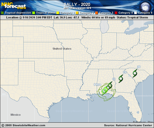
Copy of official data Tropical Depression Sally Discussion Number 24 NWS National Hurricane Center Miami FL AL192020 1000 PM CDT Wed Sep 16 2020 Although it remains a prodigious rain producer, surface observations indicate that Sally has weakened to a 30-kt depression over southeastern Alabama. The cyclone will continue to gradually spin down over the southeastern United States, and is likely to become a remnant low pressure system before merging with a frontal zone near North Carolina on Friday. The cyclone is moving northeastward near 8 kt. A northeastward to east-northeastward motion is expected over the next 36 hours or so as the system moves to the south of a broad trough over the northeastern United States. The official track forecast is about in the middle of the model guidance. KEY MESSAGES: 1. Significant and widespread flooding is expected across inland portions of Alabama, central Georgia and upstate South Carolina, and widespread flooding is possible across western/central North Carolina, and far southeast Virginia. Most widespread moderate to major river flooding will crest by the weekend, but rivers will remain elevated across southern Alabama and the Florida Panhandle. FORECAST POSITIONS AND MAX WINDS INIT 17/0300Z 31.9N 86.1W 30 KT 35 MPH 12H 17/1200Z 32.7N 85.0W 30 KT 35 MPH...INLAND 24H 18/0000Z 34.0N 82.5W 25 KT 30 MPH...INLAND 36H 18/1200Z 35.0N 79.0W 25 KT 30 MPH...POST-TROP/REMNT LOW 48H 19/0000Z...DISSIPATED $$ Forecaster Pasch |