Official Discussion issued by the National Hurricane Center
(AL182020) DATA RELEASED: 9/14/2020 9:00:00 PM UTC
|
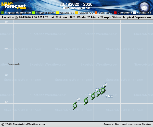
Copy of official data Remnants Of Rene Discussion Number 31 NWS National Hurricane Center Miami FL AL182020 500 PM AST Mon Sep 14 2020 Visible satellite imagery during the past few hours shows that Rene has opened into a trough of low pressure and is no longer a tropical cyclone. Therefore, this is the last advisory. The remnants of Rene will likely move generally southwestward for the next day or two while the associated winds slowly subside. Although the trough may continue to produce occasional showers and thunderstorms, no redevelopment of the system is expected. Additional information on this system can be found in High Seas Forecasts issued by the National Weather Service, under AWIPS header NFDHSFAT1, WMO header FZNT01 KWBC, and online at ocean.weather.gov/shtml/NFDHSFAT1.php FORECAST POSITIONS AND MAX WINDS INIT 14/2100Z 26.9N 49.3W 25 KT 30 MPH...REMNANTS OF RENE 12H 15/0600Z...DISSIPATED $$ Forecaster Zelinsky |