Official Discussion issued by the National Hurricane Center
Nadine (AL152018) DATA RELEASED: 10/12/2018 5:00:00 AM UTC
|
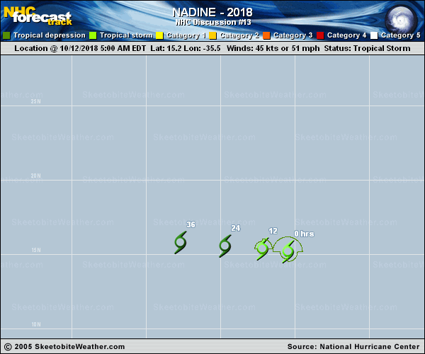
Copy of official data Tropical Storm Nadine Discussion Number 13 NWS National Hurricane Center Miami FL AL152018 500 AM AST Fri Oct 12 2018 A 0353 UTC AMSR-2 microwave overpass and GOES-16 shortwave infrared imagery show that the 30-40 kt of west-southwesterly shear, depicted in the UW-CIMSS shear analysis, is partially exposing, or decoupling, Nadine's surface circulation from the convective mass. The cloud pattern, however, hasn't changed during the past 6 hours and in fact, the cloud top temperatures in the curved band over the north semicircle have decreased somewhat. TAFB and SAB satellite intensity estimates remained unchanged, and the initial intensity is held at 45 kt. The Decay SHIPS statistical intensity model indicates that the shear will persist and increase a little more which should cause Nadine to spin down and dissipate in 48 hours, or possibly sooner. The large-scale models all show the cyclone opening up into a trough of low pressure and ultimately dissipating over the deep tropical central Atlantic at that time. The official forecast follows suit and is an update of the previous advisory. The initial motion is estimated to be west-northwestward, or 295/7 kt. A low to mid-level ridge anchored between Nadine to the south and Hurricane Leslie to the north, should steer the cyclone west-northwestward and then westward at an accelerated pace until dissipation. The NHC forecast has again been adjusted a little south and toward both the NOAA-HCCA and TVCN consensus models. FORECAST POSITIONS AND MAX WINDS INIT 12/0900Z 15.2N 35.5W 45 KT 50 MPH 12H 12/1800Z 15.4N 37.2W 40 KT 45 MPH 24H 13/0600Z 15.6N 39.7W 30 KT 35 MPH 36H 13/1800Z 15.8N 42.7W 30 KT 35 MPH 48H 14/0600Z...DISSIPATED $$ Forecaster Roberts |