Official Discussion issued by the National Hurricane Center
Joyce (AL102018) DATA RELEASED: 9/13/2018 11:00:00 AM UTC
|
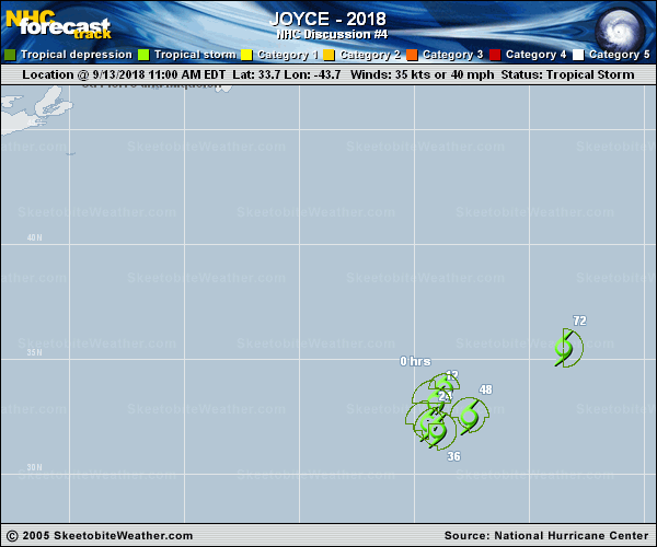
Copy of official data Subtropical Storm Joyce Discussion Number 4 NWS National Hurricane Center Miami FL AL102018 1100 AM AST Thu Sep 13 2018 Joyce's satellite presentation is less than impressive this morning, with the low-level center exposed to the northwest of a small patch of deep convection. The initial intensity is set to 35 kt based on the latest subtropical classification of ST2.5 from TAFB a 1208Z ASCAT-B overpass that showed 30-35 kt winds north and northeast of the center. Cyclone phase space diagrams still show Joyce with a shallow-to-moderate warm core, and the system remains a subtropical storm for now. Little change in intensity is expected during the next few days, as Joyce will continue to be affected by strong westerly-to- southwesterly vertical wind shear. The new NHC forecast is a little below the intensity consensus given the weakening trend seen in the global models. Dissipation is shown at 96 hours, but it wouldn't be surprising if Joyce becomes a post-tropical cyclone before that. The initial motion estimate is 245/05. Joyce is currently situated a little to the west of an upper-level low, which is currently steering the system southwestward and southward, and that should continue for the next day or so. Then, Joyce should begin to accelerate northeastward ahead of an approaching mid-level trough. The new NHC track forecast follows the trend of the latest guidance, and is a little to the west of the previous one through 36 hours. The official forecast is close to the latest HCCA and TVCA consensus aids. FORECAST POSITIONS AND MAX WINDS INIT 13/1500Z 33.7N 43.7W 35 KT 40 MPH 12H 14/0000Z 33.1N 44.1W 35 KT 40 MPH 24H 14/1200Z 32.2N 44.4W 40 KT 45 MPH 36H 15/0000Z 31.9N 44.0W 40 KT 45 MPH 48H 15/1200Z 32.5N 42.6W 40 KT 45 MPH 72H 16/1200Z 35.5N 38.5W 35 KT 40 MPH 96H 17/1200Z...DISSIPATED $$ Forecaster Brennan |