Official Discussion issued by the National Hurricane Center
Fernand (AL062025) DATA RELEASED: 8/27/2025 3:00:00 AM UTC
|
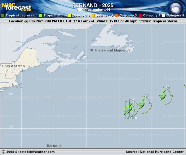
Copy of official data Tropical Storm Fernand Discussion Number 14 NWS National Hurricane Center Miami FL AL062025 1100 PM AST Tue Aug 26 2025 The deep convection near Fernand's center has persisted through the evening. Overnight scatterometer data showed reliable wind vectors up to 39 kt and the initial intensity is raised to 40 kt based on these data. Fernand is moving at an estimated 50/10 kt. The storm is expected to accelerate east-northeastward during the next couple of days as it moves in the mid-latitude westerlies. Minor updates have been made to the latest NHC track forecast track which lies near the corrected consensus model, HCCA. Simulated satellite imagery from global models suggest that Fernand will lose its deep convection in the next day or so. Model guidance holds Fernand generally steady in intensity while it transitions into a post-tropical cyclone. The official intensity forecast continues to show Fernand becoming post-tropical by 36 hours and opening into a trough by late this week. FORECAST POSITIONS AND MAX WINDS INIT 27/0300Z 38.5N 52.0W 40 KT 45 MPH 12H 27/1200Z 39.3N 49.8W 40 KT 45 MPH 24H 28/0000Z 41.1N 46.2W 40 KT 45 MPH 36H 28/1200Z 42.9N 41.3W 40 KT 45 MPH...POST-TROPICAL 48H 29/0000Z 44.9N 35.6W 35 KT 40 MPH...POST-TROPICAL 60H 29/1200Z...DISSIPATED $$ Forecaster Bucci |