Official Discussion issued by the National Hurricane Center
(AL032025) DATA RELEASED: 7/7/2025 3:00:00 PM UTC
|
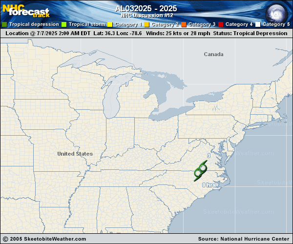
Copy of official data Post-Tropical Cyclone Chantal Discussion Number 12 NWS Weather Prediction Center College Park MD AL032025 1100 AM EDT Mon Jul 07 2025 Key Messages: 1. Heavy rainfall from Post-Tropical Cyclone Chantal will continue to result in flash flood concerns across portions of the Delmarva, New Jersey, and eastern Pennsylvania. Isolated to scattered flash flooding is possible (particularly within more urbanized areas). 2. Life-threatening surf and rip currents conditions are expected to continue at beaches along the U.S. East Coast from northeastern Florida to the Mid-Atlantic states during the next day or so. Beach goers should heed the advice of lifeguards and local officials. FORECAST POSITIONS AND MAX WINDS INIT 07/1500Z 37.5N 76.3W 25 KT 30 MPH...POST-TROPICAL 12H 08/0000Z 39.0N 74.0W 25 KT 30 MPH...POST-TROPICAL 24H 08/1200Z 41.5N 69.3W 25 KT 30 MPH...POST-TROPICAL 36H 09/0000Z...DISSIPATED $$ Forecaster Santorelli/Taylor/Shieh |